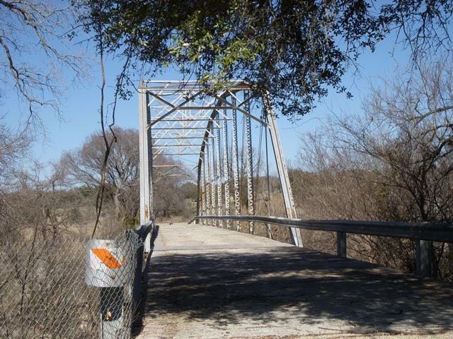
Details for Maxdale Bridge
Historical Marker — Atlas Number 5027003263
Data
| Marker Number | 3263 |
| Atlas Number | 5027003263 |
| Marker Title | Maxdale Bridge |
| Index Entry | Maxdale Bridge |
| Address | Wolfridge Rd. |
| City | Killeen |
| County | Bell |
| UTM Zone | 14 |
| UTM Easting | 611743 |
| UTM Northing | 3428938 |
| Subject Codes | bridges; design and construction; communities; disasters |
| Marker Year | 1990 |
| Recorded Texas Historic Landmark | Yes |
| Marker Location | Maxdale community, Wolfridge Rd 0.4 mi. SE of Maxdale Rd., then 0.1 mi. N to S side of the bridge over the Lampasas River. Marker reported in storage Feb. 2011. Map dot approximate. |
| Private Property | No |
| Marker Condition | In Storage |
| Marker Size | 18" x 28" |
| Marker Text | In July 1913, the Bell County Commissioners Court, in response to repeated flooding in this area, approved construction of a bridge at this site to provide access to Killeen for residents of the Maxdale Community. Before it was completed, however, the bridge was destroyed in a flood. The Bell County Commissioners Court contracted again with Hess & Skinner Engineers, agents for the Missouri Valley Bridge Company, to build this bridge. Completed in 1914, the Maxdale Bridge employs a Parker truss design, which allows for maximum strength at mid-span. Recorded Texas Historic Landmark - 1990 |
Images